Geographical Information Systems (GIS)
GIS (Geographical Information Systems)
Geographical Information Systems (GIS) are an invaluable part of any ecological project today, and mapping is a typical standard output of our projects.
GIS is used at all stages of our projects. A typical workflow of one of our standard ecological projects would include:
- Project setup: determining the site boundaries, georeferencing client site plans, determining the size and time to undertake the project, identifying any constraints and site characteristics.
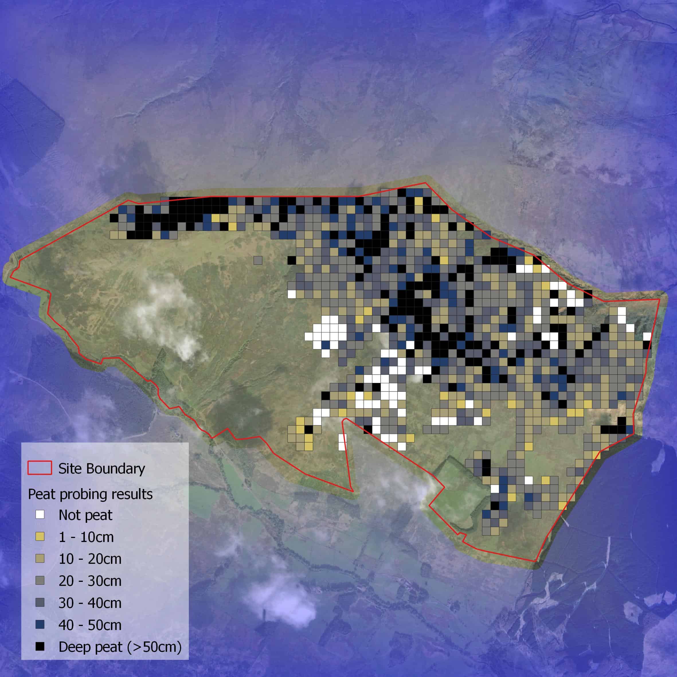
- Data capture: digitisation of survey results from our experienced ecologists such as Phase 1 habitats; location and activity of birds recorded during breeding bird surveys, location of protected species across a site.
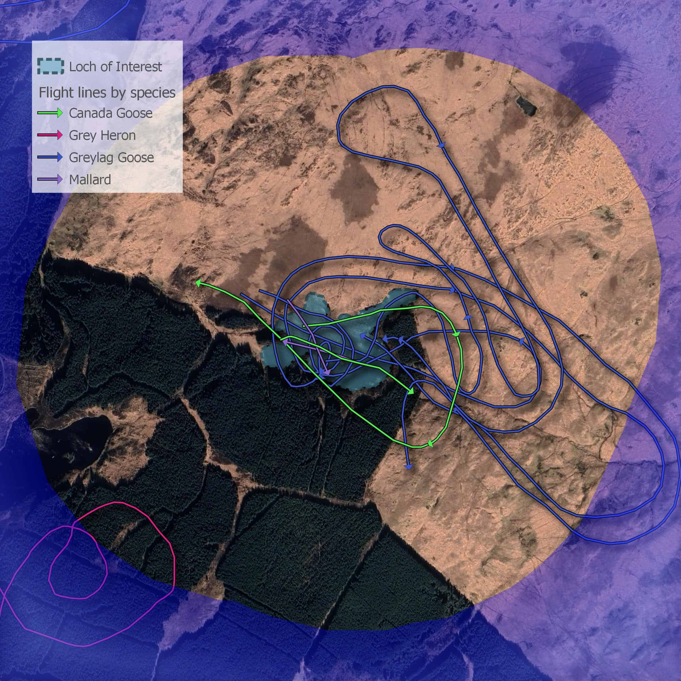
- Analysis: this can vary between projects and may include interpretation of bird records to create bird territory maps; collision risk modelling of bird flights around wind turbines; viewshed analysis of vantage point positions, areas and percentages of habitats, impacts of works and many more.
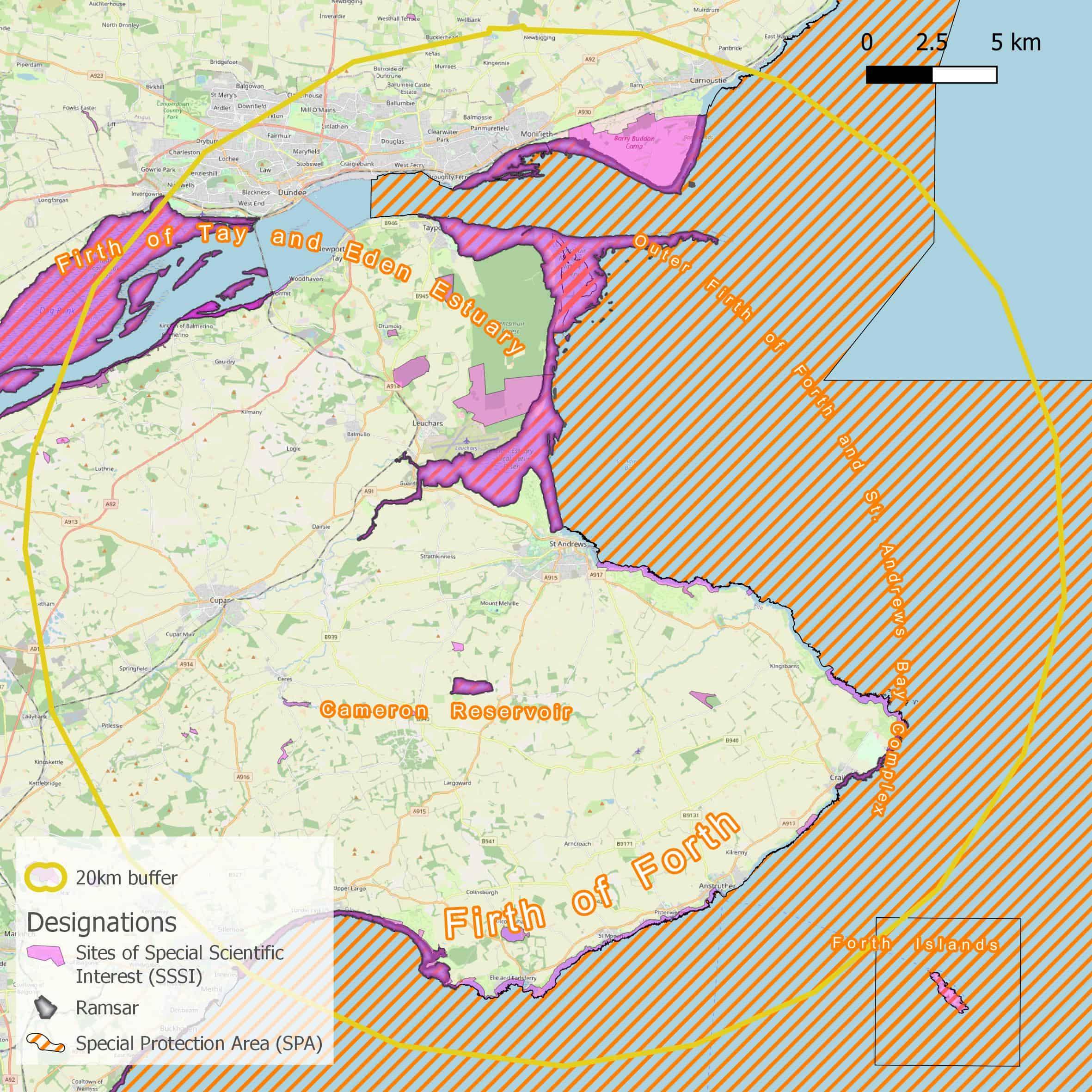
- Presentation of results: creating maps that have been tailored to the individual project to highlight key features in conjunction with the results.
In addition, Direct Ecology have also worked on full desk-based GIS projects including assessing features of Land Characteristic Assessments (LCAs).
Direct Ecology can assist you with your GIS projects large or small, and our staff are happy to talk to you about your geospatial needs.